Match your trail map to the real terrain.
PdfOnMap drops your trail map onto the real terrain — pin two matching points and it scales and rotates to fit — so the route, waypoints and contours line up with the actual hills, in a link the whole group just opens.
Stop turning a paper map to guess which way is north. Drop the trail map, pin two points, and the routes, waypoints and contours settle onto the real hills — in about a minute, no know-how needed.
Why won't a paper trail map match what's in front of you?
A flat trail map shows the shape of the route — but not where it sits on the hillside you're standing on. You turn the paper to guess north, argue over which fork it was, and hope you're even on the trail. Members squint at a scan they can't place; a club map gets redrawn for every new area. The gap is that the map isn't on the real terrain yet.
Turning a paper map to guess which way is north.
The trail map dropping onto the real hills, lined up with the ridge and the lake.
Put your plan on the real map in about a minute
Three steps: upload the drawing, pin two matching points, and share the link.
Upload
Drop in your trail map — PDF, PNG, JPG or WebP. A photo of the trailhead board or a hand-drawn club map works too.
Align
Pin two points you can find on both the map and the ground — say the lake shore and the summit. It scales and rotates to settle onto the real hills.
Share
Send a live link the whole group just opens — no login, no download. Fade between the map and the terrain; stack routes and zones as layers.
How your trail map lands on the terrain
Take the trail map you already have, pin two matching points, and it settles onto the real terrain — keeping every route, waypoint and contour it was drawn with.
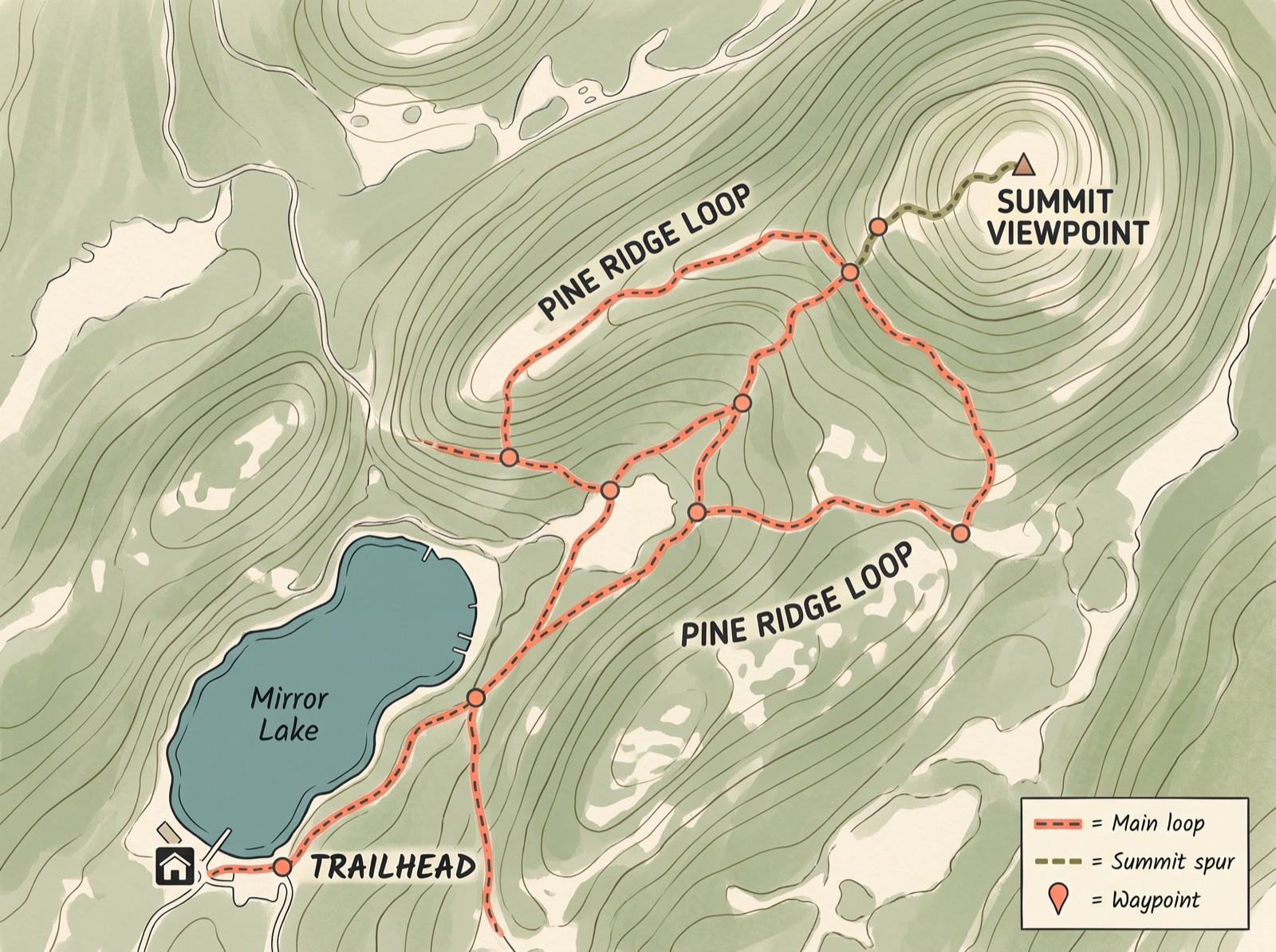
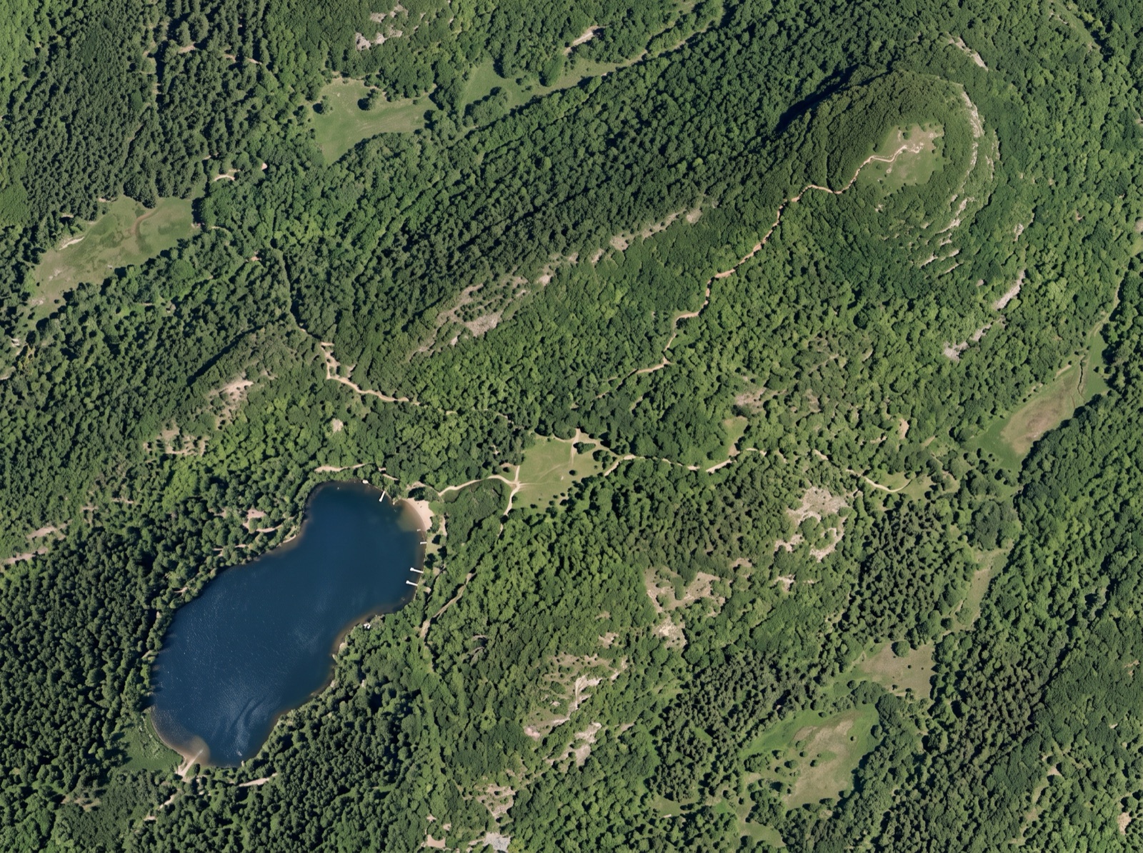
It turns a flat trail map into a shared, real-world view
Everything a club and its members need to actually place the route — on the real terrain.
Settles onto the terrain
Drop the trail map, pin two points, and it lands on the real hills at the right scale and rotation.
The fade reveal
Fade between map and terrain so you finally see where the route really runs, not just its shape on a page.
One live link
Members and visitors just open it — no login, no download, on any phone.
Stack routes and zones as layers
Summer and winter routes, or difficulty and access zones, toggled freely on the same terrain.
Plan the outing together
Everyone opens the same live map and sees the same route before you set off — no more "which trail did you mean?"
Bring the whole club
On Team, organisers and volunteers add on-map notes and roles — who edits, who just views.
Your map, your route — on the real hills
Because it's your trail map on the terrain, all of its character comes with it — the route colours, the waypoints, the club's own style. The shared map doesn't read like a technical tool; it reads like the outing. For a club, that's your route carried through every member's phone — from the planning chat to the trailhead.
Good to know
Is it accurate enough to navigate by, or should I still carry a GPS?+
Treat it as visualizing and wayfinding, not exact, measured navigation. It lines the trail map up on the terrain so you can plan the route and get oriented; for safety on the ground, keep carrying a proper GPS, compass and paper map. Pin two points and it settles onto the hills; add more points for a finer fit on a large or irregular area.
Does it work offline once I'm out on the trail with no signal?+
It opens in a browser and needs a connection to load the first time, so plan ahead: open the link while you still have signal. Where coverage is thin, don't rely on it as your only navigation — carry offline maps and a GPS. It's the shared, real-world view of the route, not a replacement for your on-trail navigation kit.
Do club members and visitors need an app or an account to open it?+
No. You send a live link and they tap it — it opens in any phone or laptop browser, with no login and no download. That's the point of the shareable link: members and first-time visitors see the same route on the real terrain without installing anything.
Our trail map is a rough, not-to-scale sketch — will it still line up?+
Yes, well enough to plan and orient from. Drop in the PDF or a photo of the sketch (PDF, PNG, JPG or WebP), pin two matching points, and it scales and rotates to settle onto the real hills — a rough or not-to-scale drawing still lines up close enough to see where the route runs. Add more points for a tighter fit.
Can the whole group see the same route and plan an outing together?+
Yes — one live link opens for everyone. For a club or orienteering group that needs to leave notes on the map and have roles (who edits vs. who just views), that's the Team plan; a keen individual sending mates a route link is covered by the free tier and Pro.
More ways to put a layout on the map
Drop your trail map on the real hills
…and send the route as a link the whole group opens.
Put your trail map on the map →